Global Temperature Measurement
Of the various ways to measure the earth’s temperature, the simplest and most straightforward method is to use a thermometer. Galileo developed the first known thermometer in the early 1600s.
His thermometer was crude by today’s standards and only narrowed air temperature readings to a fairly broad temperature range. But this was a start. Experimenters in Europe introduced liquid-filled bulb thermometers that were more reliable and accurate. In 1714, Gabriel Fahrenheit invented the first mercury thermometer, and it became the first established method for tracking the changes that the earth’s climate was beginning to experience.
There is no single location where we can place a thermometer to measure the entire earth’s temperature. During the last few centuries, local weather agencies established what has become a network of temperature-collection stations scattered throughout the world.
Groups collecting these data created standards, such as how high above the ground measurements were taken, and specified the use of ventilated enclosures. Ships and buoys made measurements of air temperatures above the ocean. During the 1940s, explorers ventured into the Polar Regions to collect temperature readings that are now represented routinely in the global temperature measurements.
New measurement locations were added continuously to the database, and measurement techniques became more refined. As this happened, scientists did not want the evolution of the measurement network itself to affect the consistency of the global averages they were trying to measure.
To prevent this, the groups tracking the data incorporated the use of anomalies, which refer to departures from an established local temperature range. The change in temperature compared with some previous level is called an anomaly. Uncertainties in measurement are most likely to affect the absolute temperature reading-or the actual number of degrees a particular station was reading. Tracking anomalies makes it easier to answer the overriding question of how the temperature is changing at a given location. Scientists then can talk about how much a particular reading is above or below normal.
Anomaly tracking is also used to reduce the possibility of calibration errors with ocean temperature monitoring and with sea-level measurements.
Today, over 7000 stations spanning the earth, over both land and the oceans perform temperature measurements. Three major organizations collect and compile temperature data to generate global averages:
1. The United States National Oceanic and Atmospheric Administration (NOAA)
2. The United States Aeronautics and Space Administration (NASA)
3. The Climate Research Unit (CRU) at the University of East Anglia in the United Kingdom
If a major league batter goes down swinging twice in a row, we might call it a slump and forget about how many runs he batted in the month before. Before the team’s manager decides to send that player back to the minors, he would be well advised to check the player’s batting average year to year.
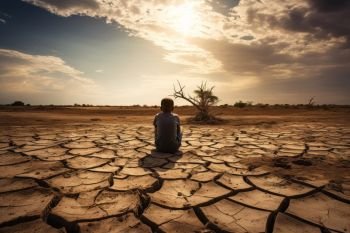
Similarly, we may be tempted to jump to a conclusion about the earth’s climate based solely on a record hot day, an unusually warm winter, and a devastating series of storms, or a drought in one part of the world and flooding in another.
However, climate typically changes slowly in ways that are hard to notice unless we look at it from the vantage point of long-term global averages.